Day 3 - Las Vegas to LA
Jimmy gave me a series of GPS waypoints to give me tracks and trails leading from Las Vegas to LA. I took some brief road notes but otherwise decided to try to rely on the waypoints along with looking for the change of tracks. He said that some of these trails were the most challenging and similar to what you would find in Africa and the Dakar. Good, I was feeling up to the challenge and was looking to getting into the desert again.
You can <click photo for enlargement> on all of these photos for the larger versions.
When I get more time I'll upload my GPS routes to the web after checking with Jimmy to see if these are public domain or his private routes.
GPS desert trails from Las Vegas to Los Angeles
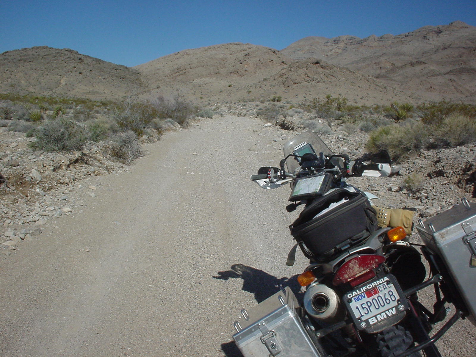
Photo - The easy road in
I followed the same trail into the backcountry as we had
ridden the day before. The only difference being
that this time I had my panniers and some extra weight in back.
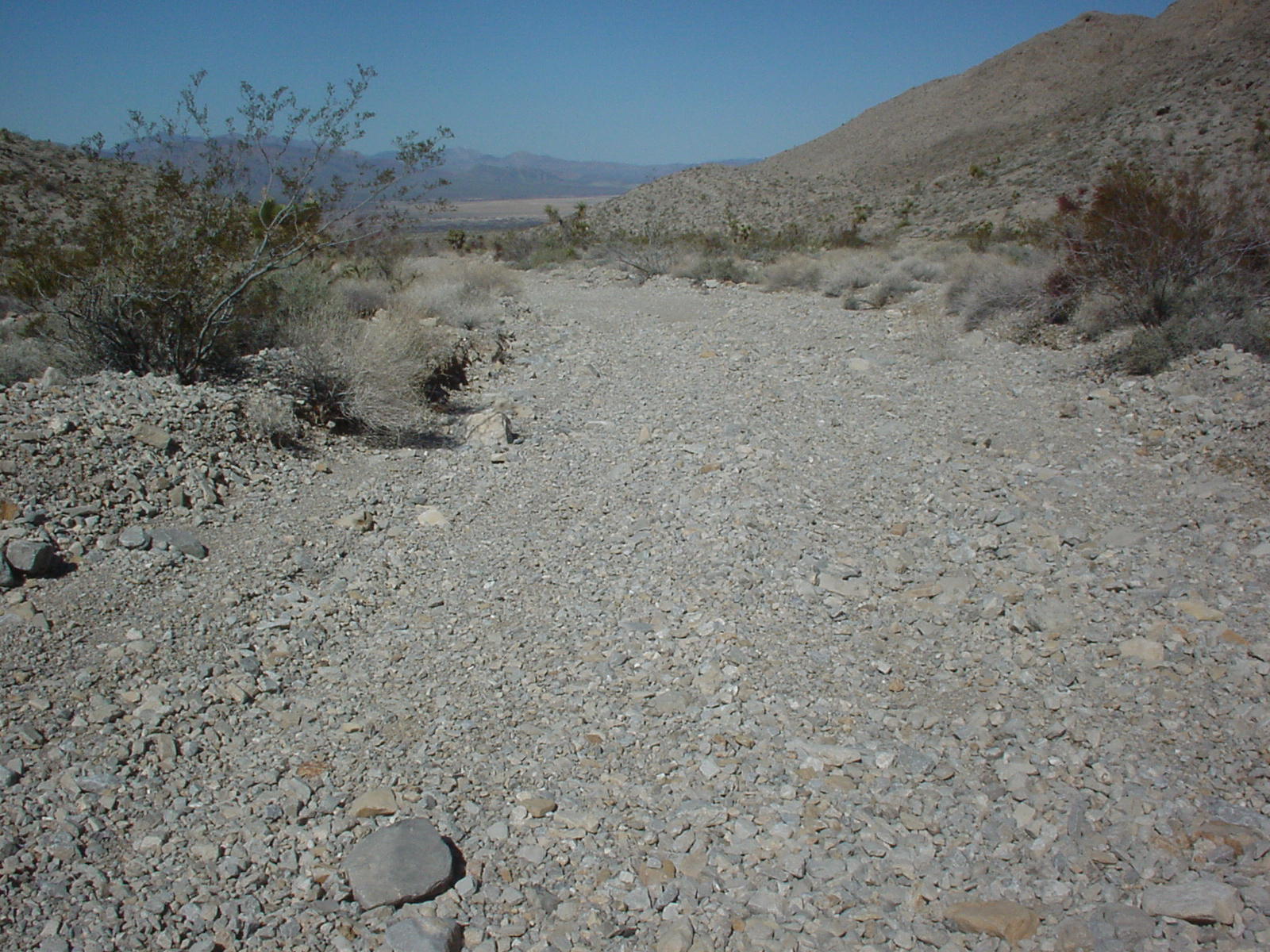
Photo - The trail changes

The routes that I was given were amazing. Each time there was
a route change the terrain would change.
This photo shows the exact route ahead that I was supposed to take (I think) and
it lead over
rocks and through cactuses. Since I didn't have a detailed map of the area I was
navigating by feel and approximate
GPS point which sometimes wasn't a help as the points were so far apart. You
could be anywhere out here.
Photo - Loose shale

Some terrain is nicer than others. This is a shot of a long
stretch of loose shaley gravel.
Speed and control sliding is the key here. I didn't like this stuff at first but
needed to ride it more
to get used to it. I need more practice still but recently have had some more
time to ride this stuff.
Photo - Loose shale, photo 2
This stuff was persistent for 3-5 miles and over some serious
hills.
My approach was speed and teeth gritting.
Photo - Accident 1

In keeping with my habit of taking a picture at every accident
that I deem worth remembering and learning from,
this picture records what happens when you don't navigate a break in the road. I
was about 1.5 hours into the ride
and settling in well. Things seemed normal and I was racing ahead at about 60
mph when I noticed that there was a ditch in the middle
of the road. Now being that I had a similar
problem in Baja - I was aware of the problems and braked hard to slow down.
If you enlarge the photo you will see the grass growing in the road on a curve where the water has cut a path across the road.
Photo - Accident 1, closeup
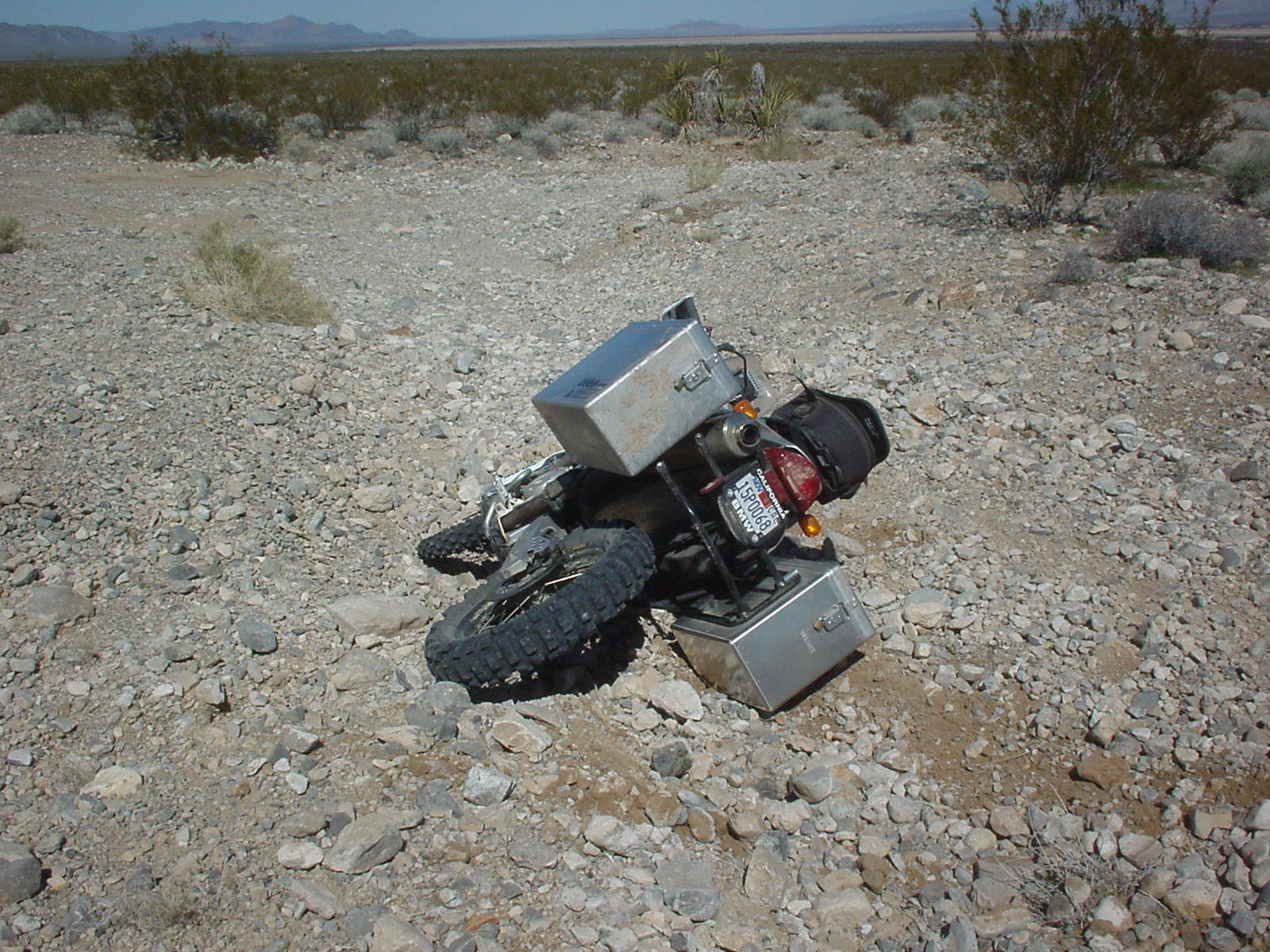
Well as you can see from this photo the terrain was quite rocky and didn't allow for easy braking. If you look at the photo above, you can see my braking line as I tried to slow the bike before the ditch.My intention was to wheelie the bike over the ditch which sometimes with the bags on is a bit harder but what happened here was that as I slowed down (too much) I slid to the right and wound up resting on the right cases. This was a slow speed stop and fall and was more embarrassing than anything. Next time I vow to get it right.
Video - Day 3 Ride